Old Iron Works in Whitchurch Parish.
Iron smelting and forging was a big business during the 17th, 18th and 19 centuries. Iron masters were usually wealthy, very important persons often holding high positions in society and politics. The Foley family is a good example. Richard Foley of Stourbridge (1580 – 1657) was a prominent ironmaster. Thomas Foley (1617 – 1677) inherited the business. He sat in the House Of Commons as MP for Worcestershire for a period. He had three sons who had interests in his business and each ran iron works in different areas. Paul managed all the Forest [of Dean] works which included Whitchurch and New Weir. In this way they could control the production and price of iron from furnaces that in turn went into their forges. They also had large contracts from local landowners for the supply of timber and charcoal. Forest iron was of the highest quality in the country.
The map below shows just a few that another ion master, Foley, owned or had interests in, in the West Midlands. Whitchurch New Weir iron works is shown on this map so Mr Foley was must also had an involvement in them.

There is often some confusion between the ‘forges’ or ‘mills’ that existed near us. Most mills were corn mills. The forge at Symonds Yat has always been referred to as ‘New Weir’ or ‘New Weir Forge’. Whitchurch Forge must have originally referred to the first mill or forge on the Garren Brook. Then there was ‘New Forge’ or ‘New Mill’ and ‘Old Forge’. Old Forge must have been the original one in this location. Almost all written references appear to be of the New Forge. We know that an older forge, Old Forge, existed beforehand and later operated alongside New Forge but we know very little about the former mill. Their exact locations are deduced from old maps showing two ‘corn mills’. Sometimes we don’t know which building is being referred to. We suspect that the original forge was much nearer the B4229 and the present road bridge and the newer forge was further upstream, possibly nearer to Marstow. One old building exists today as a residence but if this is the actual Old Forge, is not certain.
Old maps of 1884 show two ‘corn mills’, each with mill ponds or leets. The one at Old Forge is without a footpath and another at Marstow with a footpath crossing the leet, but they do not mention forges. It is likely that when the forges became redundant the mills would have reverted to corn mills.
Marstow Mill or New Mill Forge?


Map showing Old Forge and the mill that was once Whitchurch Old Forge once in our parish. Later the parish boundry was moved and these mills or forge sites are now in Goodrich parish.
The production of a useable iron involved sequentially reheating the bloomery or pig iron in a charcoal fuelled furnace and hammering it on an anvil to remove impurities. This process was called ‘fining’ or ‘forging’. It required powerful blast of air from bellows, often two working in tandem, and and at least one heavy power hammer reciprocating at up to one stroke every second or two. The power required for this could then only be derived from a water wheel. The noise would have been heard for up to a mile or more.
We have two or three sites in our parish with well documented forges and visible remains. Whitchurch Forge or Old Forge on the banks of the Garren brook, now in Goodrich parish but once in Whitchurch, another at Marstow and also at New Weir Forge on the river Wye adjacent to Symonds Yat Rapids. All produced iron plate, or pig iron for general use of blacksmiths and other iron workers. New Weir also had a slitting mill for slitting plate into square bars for sale to other manufactures such as wire worksers, chain or nail makers.
In some areas of the midlands smaller chain was made by women working in near slave conditions. See
https:/
———————————————————————————————————————-
Whitchurch Forges.
Records refer to Whitchurch Forge, New Forge and Old Forge. Originally a water mill here powered a furnace smelting iron ore. A New Forge was built slightly further upstream to process the iron produced from the older furnace, and at some time the first furnace was converted into a forge as well, presumably Old Forge. The Old Forge building was likely to have been immediately upstream of the B4229 road bridge bridge but exactly where New Forge building was and how far upstream is not recorded. Maps from the 19th century show Old Forge mill and its leet and weir at the Old Forge area, but the only other mill and leet on the maps is nearer to Marstow. So this must be New Mill. Neither had any continuous connection to the house that still stands on the banks of the Wye on the other side of the road from Old Forge but is stated the iron ore was probably imported and the finished iron product exported via the wharfs where this house still stands. At some stage the then owner, then a Mr — appeared to have some business interest in Old Forge.
The earliest record of Whitchurch Forge in 1633. (There are suggestions of this being built on the foundations of an earlier mill which was probably a corn mill.)
George, the 6th Earl of Shrewsbury and his son lived in Goodrich Castle. between them they owned and operated many mills and forges in South Yorkshire, Derbyshire, Lancashire and Nottinghamshire. This was already a big business before the time the industrial revolution.
His Son The last Earl of Shrewsbury had three daughters and each married a nobleman ironmaster, the Earl of Pembroke, the Earl of Kent and the Earl of Arundel. On the death of his father in 1617 he took complete control of all these works. In 1623 the 8th earl of Kent succeeded but died in 1639. In the meantime he married Elizabeth, the second daughter of the 7th earl of Shrewsbury at Goodrich Castle and so by marriage Goodrich passed to the Earls of Kent.
A written record of an indenture dated 1633 details the terms of alease and an inventory of Whitchch Forge from Henry Earle of Kent and lady Elizabeth, Countess of Kent to a George Kemble of Pembury Castle, Herefordshire, together with’all the forge called New Mill Forge in the parish of Whitchurch, with all the houses, utensils, tools and appurtenances (but not the fish, rights to catch fish and access to the banks of the waterway to fish in the ‘Forge Pool.). The terms of the lease were for 7 years at a cost of ‘four score pounds’ per year.
To give us an idea of the size of the operation the inventory lists the following as transcribed:
- Imprimis one great hammer.
- One great anvill.
- Three Quashes.
- Three ringers.
- Three ffurgons.
- Three paier of greate Morden Tonngs.
- Three paier of shinglinge Tongs.
- Six Clamsgreate and smale.
- One great stedge.
- Three hande hammers.
- Three iron dyshes.
- Onr greate shovell.
- Three Morrise Barres in the Chimneis.
- Three Tuirons.
- Three Cole Basketts.
- One wheelebarough.
- One Iron Cole Rake.
- In the upper finery 5 platts of Cast Iron.
- in the lowe finery 5 platts of Cast Iron.
- In each finery one Loope plate.
- In the Chafferey5 platts of Cast Iron.
- Two pairs of finery Bellowes with all furniture and belonginge.
- One pair of chafferey Bellowes wtall furniture.
- Ffourteene hoops upon the hammer beame.
- Ffoure hoops upon the two chafferey beame.
- Eight hoopes upon the two finery beames.
- One Wrought Hurst. (or Hurse).
- One Boyte.
- One Braye upon the hammer helve.
- One hoope upon the hammer blocke.
- All the gudgions and brassess to the four beames.
- One greate ringe of Cast Iron upon the upp finery shafte.
- Three greate plats of Cast Iron set under the Anvill in the w[eigh]t of one Tonn which if Sir Jouhn Kile doe not make good to Mr Kemble they must be noe parte of this inventory.
From this we see that New Whitchurch forge was a small sized operation with only one ‘great hammer’ powered from a water wheel. There are no records of New Weir’s output until the year 1748/9 when it produced 42 tons of iron. By comparison nearby Bishopswood forge was averaging nearly 200 tons per year and Lydbrook averaged about 150 tons.
From other documents we find that ‘Whitchurch Forge’ as it became known, was mentioned again both in earlier times and in later records showing us that it had several owners. ‘Baronet Kyle’ (Sir John Kyle) owned or leased it in from 1629 to 1633 after which it apparently ceased to operate for a short period. It was started up again in the same year and operated by Kemble until 1670 when the Whitchurch Forge lease was transferred to Rudhale Gwyllim (Surely this must be the same Gwyllims that owned and lived ‘Old Court’ in Whitchurch at the time.) and records have it that it was operated by George Scudamore, (another important Herefordshire family who also held the lease on a forge at Monmouth), until it was rebuilt by a Mr William Rea in 1720 who leased several other forges and worked them in partnership with others.
The leasee would hire managers to operate his mills and forges on a day to day basis who would in turn hire his own labour paying in the region of 8 to 10 pence per day probably working seven days so long as the water levels permitted the mill to operate. Managers would likley be paid according to the output in tons.
The winter of 1646 was a bad one for bridges, weirs and mills. Flood waters and ice flows damaged bridges, breached weirs and flooded mills. Whitchurch did not escape. A breach in the flood gates and damage to the head (dam) and swept away much soil from the banks and put New Mill Forge out of operation for weeks whilst extensive repairs were undertaken. An account of monies spent on labour and materials. The bridge over the leet was not repaired until the following year.
The total cost of labour for 369 1/2 man days plus 30 shillings of sundry materials came to £22 pounds, 15 shillings and 9 pence. This did not account for the large quantities of raw materials such as lumber, stone and soil that presumably came from direct from the estate of the Earl of Shrewsbury and so does not appear in these accounts.
The last we hear of Whitchurch New Mill operating as a forge was in 1727 when the Reas’ were in debt to the Scudamores and owed wages to their own employees at the same time. By now the ‘New Weir’ works at Symonds Yat, as it is now called, had been operating on a much larger scale for some forty years so it is likely that the Whitchurch Forge ceased to be profitable in the face of such competition.
——————————————————————————————————-
New Weir.
There is little or no written work surviving to tell us of the life and work at New Weir. It was a much larger than at Whitchurch having three water powered hammers and a slitting mill. It was apparently quite famous at the time and a favourite with tourists who made mention of its great clouds of smoke and the thunderous noise from its hammers.


The [Herefordshire Archaeology] report provides an account of archaeological excavation at New Weir Forge, Whitchurch, Herefordshire. New Weir Iron Works was essentially an iron-working forge for refining and processing cast (or pig) iron produced at various smelting furnaces in the region. It worked from at least 1570 and up to the early 1800s when it is thought to have gone out of use.
A reasonable amount of documentary evidence survives from census reports and legal contract documents held in archives today and from these a very basic history of the site can be gleaned.
Also from the 1758 survey map by Daniel Williams below.
Detail of the 1758 Survey by Daniel Williams, A – Orchard, B – Garden, C – Mr Partridge’s House, D – Forge, E – Slitting mill, F = Forge pond.

New Weir was predominantly a charcoal fired forge. Many similar sites continued to be reused and adapted as various improvements and improved processes came and went. In the case of the New Weir Forge however the site had gone out of use by the end of the 18th century and was not reused or modified after that time.
Prior to excavation the works survived until quite recently as a complex of earthworks, suggesting buried wall lines and some reasonably well preserved masonry features consisting mainly of revetment walls and buttresses, some standing to as high as 3m. It is thought likely that much stone from the former buildings has been
removed from the site to be used in nearby domestic buildings.
The documents still available includes letters, leases, newspaper reports and adverts, tourist descriptions, paintings and maps. One of the earliest descriptions in 1695 sets out the function and extent of the works and associated buildings it states that – “The Earl of Kent, upon an old foundation has lately built his forge, which is one of the best in England, having two hammers and three chaferies or fineries which can work in the driest time of summer. There were besides, a dwelling house for ah tenant, stables, warehouse and outhouses and several dwelling houses lately built for above 30 families”
In 1684 George White had leased the site and it is further reported that in 1706 he constructed a slitting mill on the site. A slitting mill was used to cut iron plates into square section rods for making artefacts such as nails or providing the raw material for wire making. At some point this may have been converted to a rolling mill for producing iron plate as by 1811 the lease was being advertised in the Hereford Journal and the Gloucester Journal. It is described as “A capital Iron Forge with two hammers, three fineries, a chafery, an excellent rolling mill, a commodious dwelling house, divers cottages, stables, outhouses and all other necessary conveniences.”
Two surviving surveys are extremely important and informative. In 1758 “An Exact Map” of the site was produced by Daniel Williams. The detail shown is wonderful. The layout of the works is shown including the forge and slitting mill, Mr Partridge’s house, garden and orchard (John Partridge “Ironmonger of Ross” had taken over the lease in 1753). Three water wheels are depicted on the works buildings. The weir, lock and capstan for hauling boats upstream through the lock are also shown above the works.
In 1779 a plan drawn in connection with a proposed canal to ease navigation past the weir and the shallows below it again shows the forge and slitting mill. The building behind these is presumably the house. Only these three are outlined in bold and it appears that the other constructions along the riverbank were not substantial buildings but possibly open yards, working areas or lean-tos. An important feature on this plan is the double outlet from the slitting mill wheel pits and a semicircular buttress of masonry between the two. This confirms that the mill had two wheels. These features are still visible in the river bank and bed and corroborate the site of the slitting mill. It is also clear from these sources that new weir is a multi phase complex. There is the reference above to it being built on “old foundations”. There is also a report that states that in 1706 part of the works, the storehouse, was erected on a parcel of land called “Sinderhill”.‘
In the 18th and 19th centuries the area around New Weir became well known for its landscape and natural beauty. A pencil sketch by Joseph Powell of about 1810 was published by Coates and Tucker, is in a different artistic tradition and appears to be an accurate depiction of what was actually there. Although Coates and Tucker state that Powell, using artistic licence, has switched the left bank of the river to the right, the drawing is in fact correct and looking not as they thought across the river at the forge but across the forge pond, note the grills which were to prevent debris entering the wheel pits rather than protecting the outlets.

The angled revetment on the right with the bow of the boat is tucked in behind it, also matches perfectly with the angled depiction of the forge pond on the 1758 map. The building to the left is the slitting and or rolling mill. It would have had two water wheels, the right hand one is shown. The area on the right appears to be a storage and quay area complete with steelyard balance.
According to the plans available the building on the right of this area should be the forge.
The painting by Michael Angelo Rooker is also useful here in that it confirms the use of the leat by boats. The slitting mill, gable end on to the river, is the first building on the left.
The 1779 Survey by A Whitworth identified the slitting mill and and the forge.
A sketch of New Weir in about 1810 by Joseph Powell (in Coates and Tucker). The view is across the forge pond, the building with the water wheel is the slitting / rolling mill. It would have had a further wheel on the left hand side.
A late 18th century (c1783) illustration by Michael Angelo Rooker showing a boat using the leat to access the iron works
Apart from those features directly associated with the iron-working site no other archaeological features or finds are recorded from the site. Close by however are a number of other industrial
sites some probably associated with the iron works, for instance, limestone quarries, charcoal platforms and a number of trackways. The weir has completely disappeared and even its original location is not entirely clear. The rapids are now an important area for white water kayaking and engineering has taken place and the river bed altered to improve this. The lock and associated features on the other side of the river were probably completely destroyed at the time of the construction of the railway line that runs just above the river and is now a forest track and footpath.
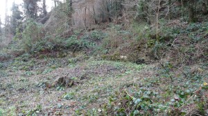
Physical Remains.
Although very little detail is visible on the site the composition of the works is described in the various documentary sources and the basic layout is fairly clearly depicted in the historic maps and plans. It is therefore possible to interpret the earthworks fairly accurately.
The main leat, forge pond and tailrace can all be readily identified today. They survive as broad, shallow depressions. They are heavily silted up, and the original depth of the features is unknown. On the west side of the leat and forge pond are the remains of revetment walls, and the tailrace is marked by an impressive stone arched culvert where it emerges from under the works. The exact configuration of wheels and water management is not clear, but the water must have run through a culvert below the works, possibly powering wheels as it went, before emerging into the tailrace.
The most visible building remains on the site are those that are thought to be the owners/tenants house. This is built into the hill slope and the back wall of the building and buttresses, again comprising sandstone masonry, act as a revetment wall and survive to a height of over 4mts.

The base of this surviving portion, is at the same level as the works, and may have functioned as storerooms or offices, the accommodation proper perhaps being on upper floors.
The terraced gardens and area of the former orchard are recognisable on the ground today as earthwork platforms and collapsed walls.
Between the house and the river lay the main works comprising the forge, slitting mill (later rolling mill) and ancillary buildings. Evidence from the two historic maps places the slitting mill at the northeast end of the main complex, in an area between the forge pond to the west and the river to the east. The site of the building is represented now by a low earthwork mound, the flanking wheel pits by slight hollows and the tail races and associated masonry are visible in the river bank and bed below.
The forge occupied the area in the centre of the complex but the earthworks here are the least comprehensible. The remains of the probable ancillary buildings are raised above the
general level of the works ranging along the river bank and survive as prominent earthworks with wall lines showing intermittently at or only slightly above ground level. In places individual buildings or rooms can be identified and part of a flagstone floor is exposed by riverside path erosion. The tailrace arch and adjoining wall that marks the southern extent of the forge area are extremely well preserved. The wall survives to a height of about 3mts.
Riverside revetment walls separated and protected the works from the river. These have been interpreted by some as also doubling as a riverside quay. This is unlikely as there is a significant difference in height between the building level and river level of about 4mts and the presence of the shallows here would anyway have precluded this use by boats. All the documentary evidence suggests that boats used the leet and forge pond to enter the works from above the weir for loading and unloading. On the slopes above the site are the remains of the cottages referred to in various documents. This particular one appears to be tripartite with a yard or small garden area cut into the hill slope behind.
Another major feature of the site is the large deposits of slag and other waste. The area surrounding the various structural elements, the river bank and in places the river bed itself are solid deposits of slag. Hearth bases and structural material including brick and stone are visible within the eroding riverbank. This material extends downstream well beyond the area of the main works complex.
The trackway running immediately above the site is thought to be associated with the iron works. This and other tracks are shown on the historic maps. In character the track is reminiscent of a tramway; it is metalled with a consistent surface though as no sleepers or other features are visible it may only have been a cart track (This metalling may be later improvement carried out by the Forestry Commission for woodland management purposes).
For the full archaeological report see our Links page.
Some more pictures of what it might have looked like all those years ago.


Dear Peter,
I can’t find you are a member of the Woolhope Club – I only see email addresses of members as I manage the Club’s website – so probably you have not seen the papers that I have written on the hisrory of Goodrich manor (which includes Whitchurch, Ganarew, parts of Llanrothal and Llangarron). My 2010 Presidential Address to the Club was on the history of New Weir. As a non-member you can’t access the 2010 Transactions online until next year, but if you send me your email address I can extract the paper for you and send it.
Regards, Roz Lowe
LikeLike
Ros. Thank you for contacting us. I / we are not members of the Woolhope Club but We would be very interested in reading anything you have written on our local history and share it with our members. You mention your research on Goodrich manor and New Mills. Are you local yourself?
Peter Hunt.
LikeLike