Little Doward walk 1a and b.
Walking time 1,1/2 to 2 hours. Hilly but not steep.
There are several variations on this walk but here is one with so much to see. Part way along there is an alternative route or detour to see a part restored lime kiln. I have designated this route ‘b’ on the map but it re-joins the main route further on.

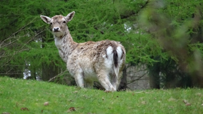
Start at the car park near Ganarew and the deer park. ‘P’ on the map.


I usually take the steps up the bank not far inside the gates beside the deer park, but you can plod on up the main track if you wish.


If you stick to the main track it turns sharp right and soon there is a smaller level grassy track leaving on the right. take this. Alternatively if you go up the steps on the right just inside the gate, this takes short cut but it is a narrow path through the woods and slippery in places, steep towards the end where it joins the other route just before the metal gate.


Go through the gate on your right and almost immediately there is a smaller grassy track on your left. This track eventually peters out to nothing but in the woods. Before the end you will see some of the most spectacular layered rock formations and well worth the detour.


These rocks consist mainly of quartz conglomerate over layers of old red sandstone layered down an flat plains during the Devonian period, 416 to 299 million years ago added to later with limestone and more sand during the Carboniferous period, 359 to 299 million years ago. Much later still, during the several phases of the ice age, 18 to 10 million years ago, these rocks were heaved up to the angles you see today. The larger boulders you will see have probably been in the same place here since then. In other places they are the result of much more recent quarrying.

No footpaths much further than this so you must retrace your way back to the main track.


Continue along the grass track over a gentle rise and then downhill with the deer park on the right, to a, muddy in winter, hollow where the public access path turns left and up the hill.
Look out for more fallow deer here. They are watching you even if you don’t spot them.
On your left, not far before the gate, you will see a sort of small ‘cave’ beside the track. This was probably used by neolithic people as a night shelter about 10,000 years ago. Inside it is dry, sheltered from the elements and with a thick bed of leaves on the floor making what would have been a very comfortable temporary dwelling for some of the earliest Doward residents.


Proceed through the gate and on the other side is a fork in the track. Right takes you down to the riverside footpath, another route but not ours today.
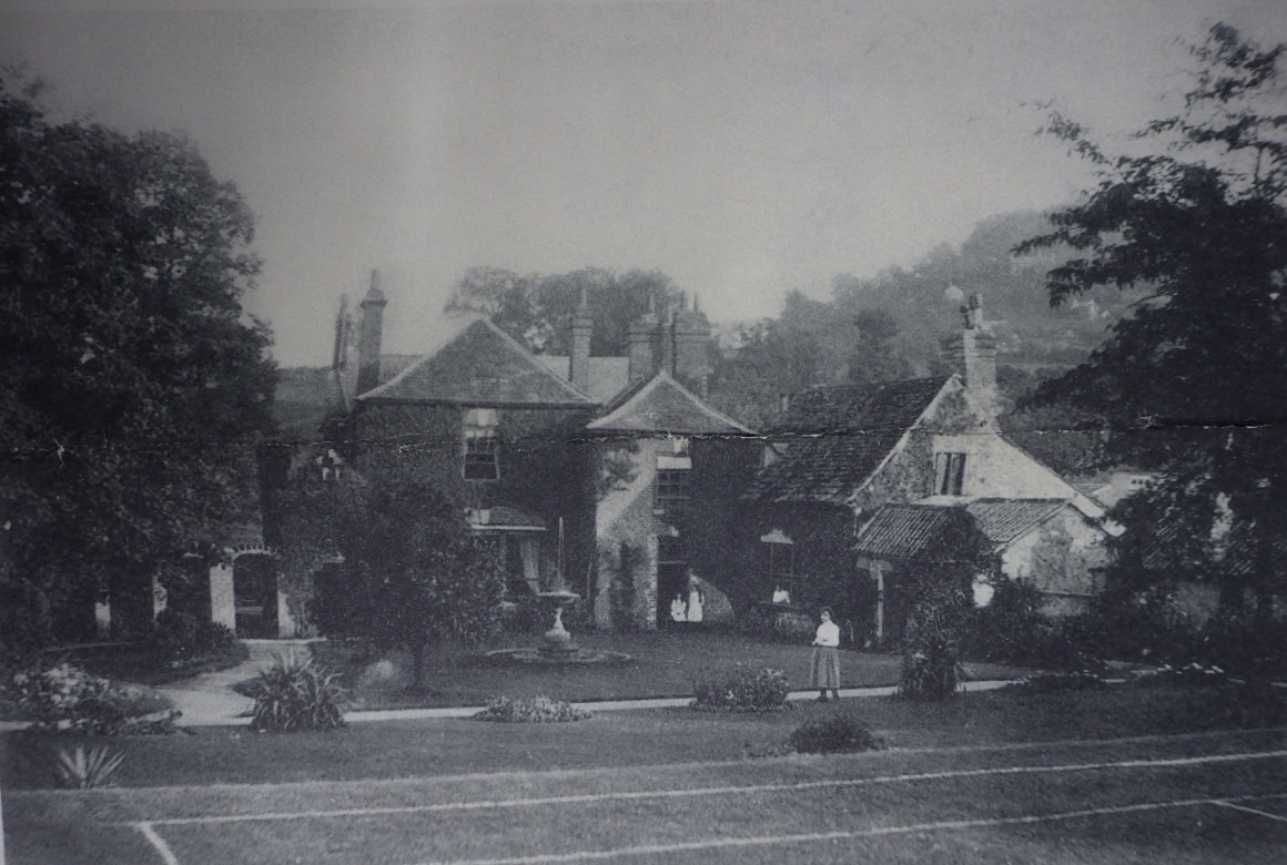
The owner of this land in the Victorian times was a Mr Richard Blakemore, the gentleman who constructed these series of carriageways over Little Doward in order to entertain his guests, then no doubt an impressive treat, but some of his other exploits were shear vandalism by today’s standards.
There are some excellent examples of pollarded beech trees bordering the track, a legacy from when most trees on the Doward hills were cut for charcoal burning. Being in private hands for so long , Little Doward trees suffered less in this respect than those on Great Doward and there are no modern dwellings. Modern forestry still covers large parts.


Look out for a substantial track forking off on your right. This is what I have designated ‘b’ on the map. It leads down through a heavily quarried landscape to the part restored lime kiln. Well worth a visit.
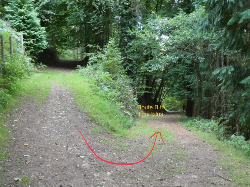


From the lime kiln it is best to retrace your route back to the main path designated ‘a’ on the map. Alternatively if you can cross the wall and work your way up hill through the woods to join the original route at the top of the hill just below the Little Doward hill fort.
Route ‘a’ will continue uphill past some stunning views to the South across the river Wye and down to the hamlet of Hadnock near Monmouth.

Just some of the views on what is arguably the most scenic part of the route.
")


You will eventually pass through a gap in the limestone cliffs that form the fortification, and you are now in the lower part an ancient hill fort, one of several in the area, occupied in the iron age.
")
")
Take the way to the right following the perimeter track round the hillfort which follows the old ditch and ramparts in places, some of which was infilled my the infamous Mr Blakemore in the construction of his carriageways.
Look out for the remnants of hut circles in the fort on the left.


This area of limestone scrub and grassland was covered in modern coniferous forest until comparatively recently but it is again home to some unusual if not rare species of wild flowers and insects including butterflies that live in this limestone environment.
")
")


When nearly at the top you will see a ‘trig point’. Many of these all over the country were used in conjunction with optical instruments to make accurate Ordnance Survey maps long before there were any satellites and satellite based maps.

At the top of the hill the track it bends left with a smaller track going right. Turn left along the straight path on the top of the hill until you come to a large and old beech tree on the top old the ramparts. Look left and you will see where our Mr Blakemore cut right through the old ditch and ramparts to accommodate one of his carriageways.

Before you go down the hill, follow round the outside of the fort ramparts for a few metres, and see the Hermitage, a small one roomed stone hut Inside which sat an old man suitably dressed, masquerading as a hermit from olden times. Of course this was just a set-up to entertain his guests.

")
return to the main track and follow it more or less straight on taking you down the hill to the start of our walk where you parked your car. The walk back to the car park is all downhill through conifers and without much interest except in the winter time when large numbers of goldcrests can be seen and heard feeding on the seeds from the fir cones. Sometimes cross bills as well. Always not far away are buzzards and their plaintive calls.
